100% Secure & Private
SDAT Converter
SDAT conversion on your own PC. No account, no subscription, no per-file quota, and nothing leaves the machine.


How to Convert .sdat Files in Bulk
1. Install reaConverter

2. Select SDAT Files
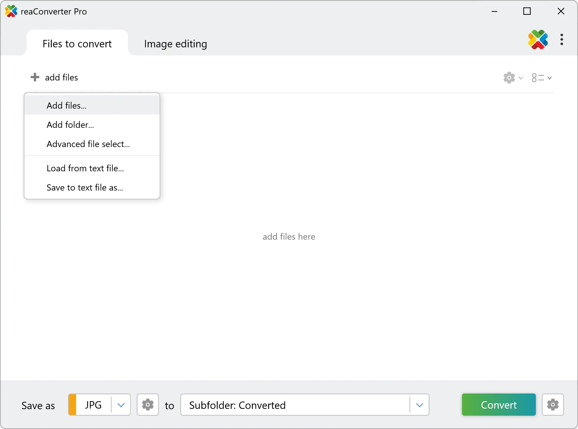
3. Start Conversion
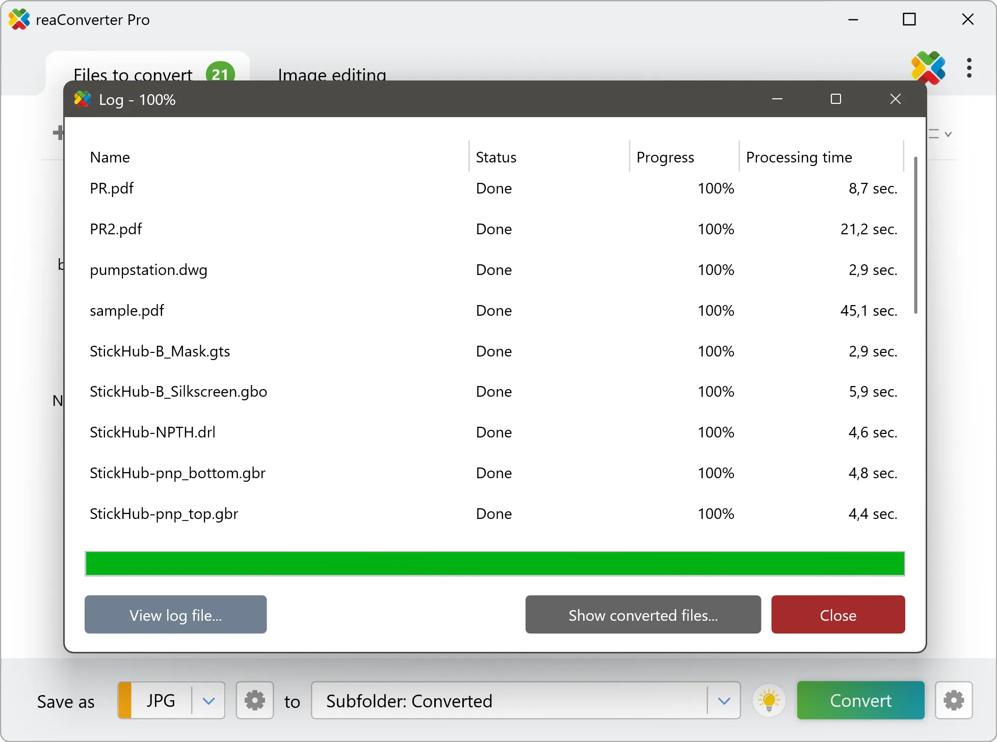
Step by step
See It in Action
For quick and effortless SDAT file handling on your PC, reaConverter offers powerful conversion tools with batch processing. Best of all, it works entirely offline — ensuring your sensitive data never leaves your computer.
GIS Toolkit
Do more with your GIS data
Need SDAT data as something anyone can open? reaConverter renders imagery and elevation grids into standard images and documents without QGIS or ArcGIS, and works through whole folders in one pass.
- Render imagery, elevation grids and scanned charts to TIFF, PNG, JPG or PDF
- Resize, crop and set DPI on the output in the same run
- Bring tiles, scenes and grids from many sources into one consistent format
- Convert incoming survey and field data automatically with Watch Folders
- Script GIS conversions from the command line for pipelines and scheduled jobs
- Keep cadastral, utility and client data on your PC: nothing is uploaded
User reviews
From those who tried it
Average User Rating:Last updated on July 28, 2026





Questions & Answers
SDAT files: Frequently Asked Questions
What are SDAT files?
SDAT (SAGA GIS Binary Grid) is the binary half of a two-file raster, in which the values are written without any header and the .sgrd text file explains how to read them. The text header lists the name and description of the grid, the unit, the number of columns and rows, the lower-left corner, the cell size, the type of numbers, whether the byte order is big-endian, a scale factor, and the value that marks missing data, often -99999. A TOPTOBOTTOM flag says whether the rows run from the top down or from the bottom up. The numbers may be bytes, 16-bit or 32-bit integers, signed or unsigned, and 32-bit or 64-bit floating-point values. The projection is kept in a .prj file, and the history of the operations performed on the grid is saved in a separate file. To convert an SDAT grid to graphics, a program reads the .sgrd header, loads the values in the stated type and byte order, flips the rows if needed, marks missing cells as transparent, and applies the scale factor. The values are then painted with a grayscale or color ramp, as for an elevation map, or as a shaded relief picture. The result can be saved as PNG, JPEG, TIFF, or GeoTIFF with the coordinates. The .sgrd and .sdat files must stay together. Supported by SAGA GIS.
Can reaConverter open SDAT files?
reaConverter fully supports the SDAT file format – open, edit, and export SDAT files to any other popular file format with ease.
Do I need QGIS or ArcGIS to convert SDAT files?
No. reaConverter reads SDAT files on its own, so the conversion needs no GIS installation and no licence. It handles whole folders at once, which suits survey archives, tile sets and data deliveries that have to reach people working in other software.
How do I change SDAT to another format?
reaConverter is a user-friendly tool for converting SDAT files. Once installed on your computer, it allows you to convert all your .sdat files at once with just a few clicks. You can even convert sdat images directly from Windows Explorer using the right-click menu — fast and convenient.
Why choose offline conversion with reaConverter?
Keep your sensitive data 100% private with offline processing that never exposes files to cloud risks. Our software meets strict compliance standards (GDPR, HIPAA, CCPA) while handling confidential documents for legal, healthcare and financial sectors.
Can I convert SDAT online?
If you only want to convert a few SDAT files, you are welcome to try our free online SDAT converter.
How can I turn SDAT files on my computer to another format?
The best way to convert SDAT files on your PC is to get a quality piece of software, such as reaConverter. This software is extremely efficient in managing a wide range of batch files conversions, including conversion from SDAT.
How can I automate SDAT files conversion?
reaConverter supports all the essential automation features, such as right-click сonversion and Watch Folders, for the most efficient automated file conversion in any software of its kind.
Can I convert SDAT files using scripts or the command-line interface?
reaConverter provides full access to all its features from the Windows command-line shell, including the command-line sdat converter.
What else can I do with reaConverter?
Convert GIS filesConvert RAW formatsConvert DICOM imagesCrop photoConvert Gerber images
What formats can I convert a SDAT file to?
Discover More
Beyond SDAT conversion
Convert .sdat files in batches of any size, with editing and processing applied along the way. The same tool also handles 800+ other formats, including CAD, medical imaging, and GIS.