ITF → IGES · Windows

Convert ITF to IGES

Online GIS converters cap file size and need an upload. reaConverter converts ITF to IGES locally, whatever the size of the dataset.

Online converters too slow for your ITF files? reaConverter works locally and handles unlimited batches. All processing runs locally on your PC, so your files stay private and secure. No command line and no scripting, unlike the usual ogr2ogr route.

.itf.IGES
4.8

Converting files since 2001

Runs offline — nothing uploaded

Read what our users say →

How to Convert Multiple .itf Layers to .iges?

1. Download and Install reaConverter

reaConverter installs quickly on any Windows PC. No dependencies, no bloatware — just a clean setup that's ready to use immediately.

2. Load your ITF files

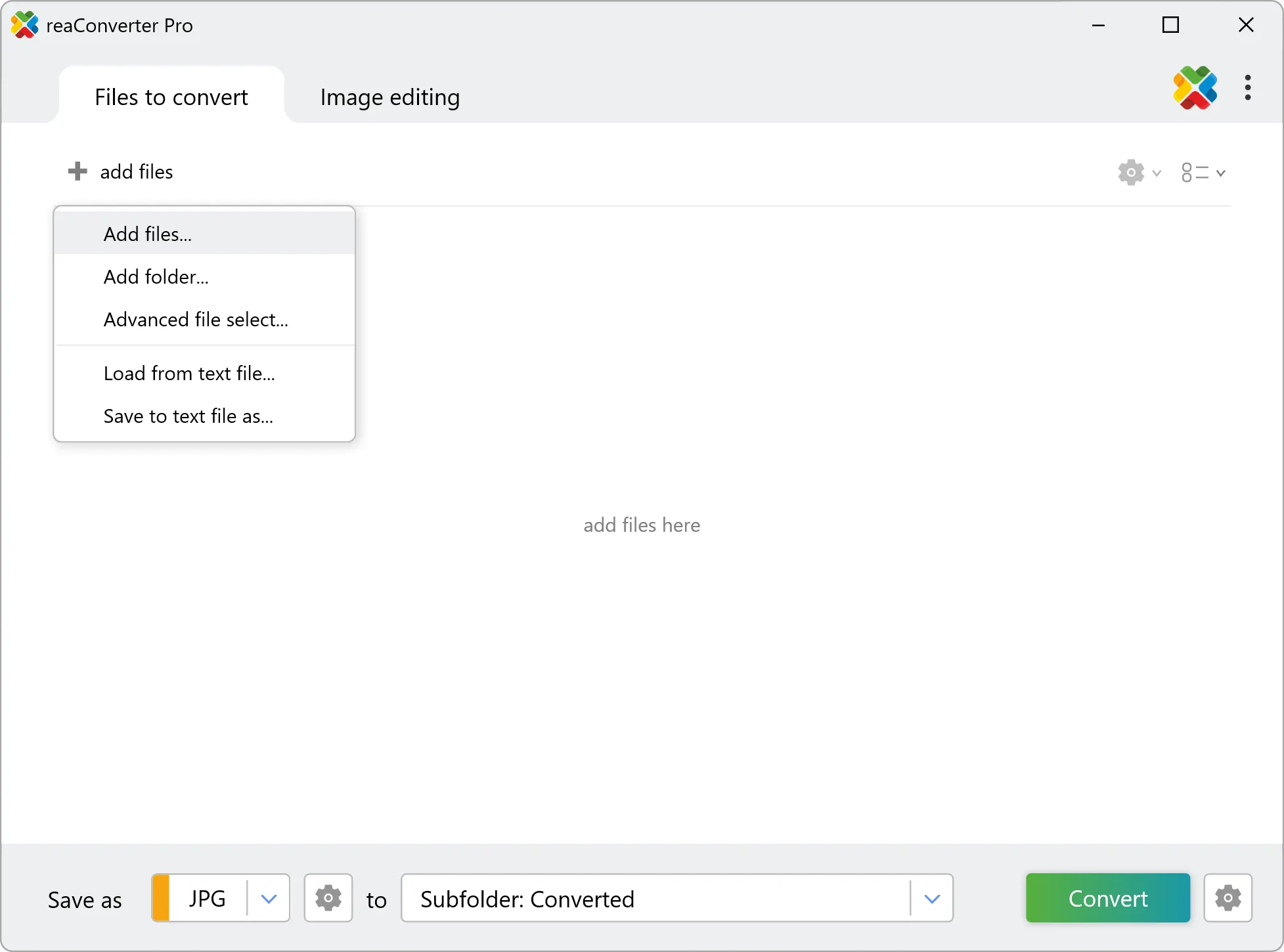
Add ITF files to reaConverter. One file or a thousand, the process is the same. Everything runs locally on your machine.

You can drag-and-drop files, browse to a folder, or add entire directory trees including subfolders.

Load your ITF files into reaConverter

3. Select IGES as output format

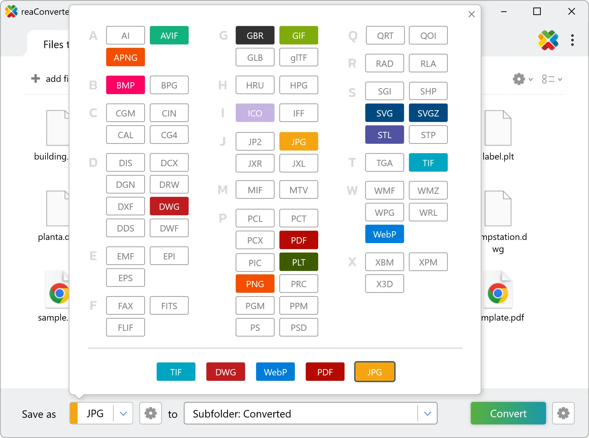
Pick IGES as the output format. Set the destination folder and optionally configure resolution, quality, or file naming.

Select IGES as output format

4. Start ITF to IGES conversion

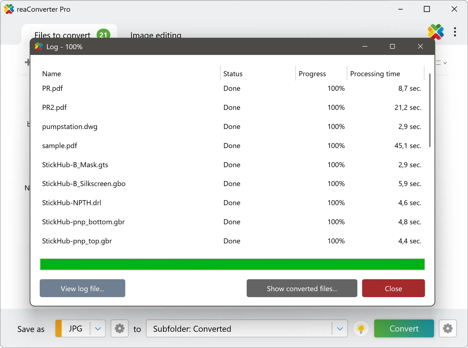
Click the Convert button to start. reaConverter will process all your files with the settings you selected.

Start Conversion

When finished, your new .iges files will be waiting in the destination folder.

Step by step

How It Works

reaConverter offers the fastest, simplest solution for converting your ITF files into IGES without GIS software - all files processed on your PC for maximum privacy and speed.

Technical note

How ITF and IGES differ in practice

Geospatial coordinates are absolute positions on the earth, and they are large: a projected easting runs to six or seven digits, while latitude and longitude are small decimals. IGES expects a drawing laid out near its own origin in millimetres or inches. The geometry itself converts correctly, but it can land tens of kilometres from 0,0, or arrive at a scale where an entire county is forty units across. Zoom to extents first, then measure one known distance before dimensioning anything.

Map Data Workflow

From map data to a working drawing

Site plans, utility routes and parcel boundaries often start out as ITF and end up in IGES. reaConverter turns the layers into drawing entities in batch, so a full project folder moves across in one run.

  • Convert every layer in a folder to IGES with the same settings
  • Go the other way too, from DWG to Shapefile, when the GIS team needs the drawings back
  • Render the same data to PDF for a quick review copy
  • Pick up new data automatically with Watch Folders, or script the job from the command line

Everything runs on your PC, which matters for cadastral, utility and client data that should not pass through an upload form.

GIS data conversion

User reviews

What people say after the first batch

Average User Rating:4.8
Last updated on September 13, 2026
An ultra-fast solution for minimizing file sizes. The entire conversion process takes just 3 minutes!
Logan B.
Logan B.
Satisfied Customer
I use the online converter — it’s quick and hassle-free!
Jian Wong
Jian Wong
Happy Online User
Working in a print studio means constantly juggling obscure file formats. I used to waste hours Googling converters or installing random software — until reaConverter became my Swiss Army knife. Install it once, and you're set forever. No internet? No problem!
Helen Evans
Helen Evans
Satisfied Customer
Your solution was buried deeper in search results than it should be. After struggling with unclear alternatives, I found your guides — finally, instructions that made sense for a first-time user like me. Excellent work!
Richard E. Miller
Richard E. Miller
Satisfied Customer
Converts files in seconds! Finally a tool that's both fast and simple to use.
Wei Chen
Wei Chen
Happy User
I'd been searching for reliable conversion software forever — reaConverter has everything I need! After installing and watching the tutorial, I had my files converted to the perfect format in minutes. Flawless experience!
Sanjay Mehta
Sanjay Mehta
Satisfied Customer

FAQ

ITF to IGES Conversion

Can reaConverter convert ITF to IGES?

Yes! reaConverter instantly converts .itf to .iges with perfect quality preservation. With its batch processing feature, you can convert multiple files at once in just a few clicks. You can even convert images directly from Windows Explorer using the right-click menu — fast and convenient.

What is reaConverter used for?

reaConverter is a Windows converter for 800+ formats, GIS data among them. For ITF to IGES it replaces the usual detour through QGIS, ArcGIS or ogr2ogr: add the files, pick the output format, and the whole batch converts offline. Surveyors, planners and engineering teams use it to pass data between GIS, CAD and everyday document formats.

Why choose offline conversion with reaConverter?

reaConverter is a software program that is used for offline files conversion. Your proprietary documents never leave your computer – essential for architects, engineers, healthcare and government contractors handling classified projects. Meets GDPR, HIPAA, CCPA, and corporate security policies by ensuring files never cross borders or third-party systems.

Can I convert ITF to IGES online?

If you only need to convert a few ITF files to IGES format, feel free to try our free online free online ITF to IGES converter — perfect for small batches with no installation needed!

How can I turn ITF files into IGES on my computer?

The best way to change ITFs to IGESs on your PC is to install a quality piece of software, such as reaConverter. This software is extremely efficient in managing a wide range of batch files conversions, including conversion from ITF to IGES.

How can I automate ITF to IGES files conversion?

reaConverter supports all the most useful automation features such as right-click сonversion and Watch Folders for the most efficient automated files conversion in any software of this type.

Is there a way to convert ITF files to IGES using the command prompt?

reaConverter provides full access to all its features via Windows command line, including a high-performance command-line itf to iges converter for batch processing.

What else can I do with reaConverter?

Convert Gerber filesConvert RGB to CMYKVectorize imagesChange image bit depthChange format settings

Related conversions

Other ways to convert ITF files, and other sources that convert to IGES.
Discover More

Beyond format conversion

Batch conversion, editing, and processing across 800+ formats, from RAW and HEIC to DICOM, DWG, and PDF. Everything runs locally, with no cloud and no upload limits.

Free trial · Windows 10/11 · v8.0.250 · Files never leave your computer

reaConverter software